Topic: Google Maps

Google Maps comes up in 8 chapters across 8 episodes of The Higherside Chats Free Show, from May 2014 to November 2023.

May 2014 November 2023

Related topics

Dan Xuisoko | The Hollow Earth, The Lunar Wave, & Alchemical Eternal Youth
• 20:26 - 23:46

Dan Xuisoko | The Hollow Earth, The Lunar Wave, & Alchemical Eternal Youth

Polar Wind Patterns and Censored Satellite Imagery

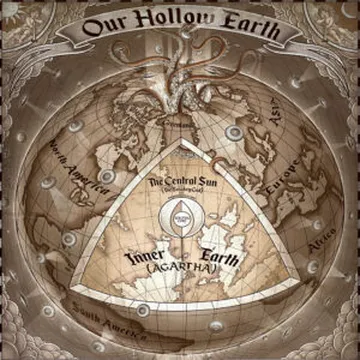
Zusoko describes his investigation into reliable wind maps that show massive vortices at the geographical poles, which he interprets as air diving into a physical opening. He points out that satellite imagery on platforms like Google Maps often features large censored squares over the polar regions, officially attributed to national security. While initially skeptical, Zusoko admits that the lack of scientific counter-arguments and the presence of these thermal disturbances led him to find the hollow earth theory plausible.


Michael Joseph | The Many Esoteric Elements Of The JFK Assassination Ritual
• 2:58 - 5:42

Michael Joseph | The Many Esoteric Elements Of The JFK Assassination Ritual

Methodology for Analyzing Metaphysical Elements in Dealey Plaza

A researcher describes how a Google Maps search of Dealey Plaza revealed a layout resembling the Kabbalistic Tree of Life, sparking a deep dive into ritual encoding. The analysis avoids identifying specific culprits of the JFK assassination, focusing instead on how the event reaffirms the existence of a spiritual world. The discussion introduces a series of slides detailing seven distinct ritual layers identified within the historical record.

dealey plazatree of lifegoogle mapsritual encodingmetaphysical
Ryan Zimmerman | Pizzagate 2.0: International Child Trafficking & The Elite
• 45:09 - 51:45

Ryan Zimmerman | Pizzagate 2.0: International Child Trafficking & The Elite

Cerberus Capital Management, Corporate Web and Political Donations

The corporate structure of Cerberus Capital Management is explored, noting its ownership of diverse assets ranging from DynCorp to satellite imaging software used in Google Maps. A $40,000 donation to Hillary Clinton's campaign is cited as a direct link between the private equity firm and the political elite. The discussion emphasizes how these massive conglomerates use shell corporations to move operations and avoid accountability during federal investigations.

cerberus capital managementhillary clintongoogle mapscbsshell corporationsveritas
Mary Joyce | Secret Bases, Little People, & Skyships Over Cashiers
• 8:46 - 10:53

Mary Joyce | Secret Bases, Little People, & Skyships Over Cashiers

Sugarloaf Mountain, Buffer Zones and Map Censorship

Military authorities have reportedly acquired land around Sugarloaf Mountain and Chimney Rock Park to create buffer zones that keep the public away from secret entrances. Digital mapping services like Google Maps allegedly airbrush or censor these locations, replacing visible infrastructure with images of trees. One specific hexagon-shaped entrance was reportedly scrubbed from online maps after being discovered by researchers.

sugarloaf mountainchimney rock parkgoogle mapscensorshiphexagon shape
Harry Hubbard | Ancient Map Mysteries, Phantom Islands, & The Hollow Earth
• 18:51 - 20:32

Harry Hubbard | Ancient Map Mysteries, Phantom Islands, & The Hollow Earth

NASA Satellite Composites, North Pole Image Manipulation

Harry Hubbard claims that modern satellite imagery from NASA and Google Maps occasionally reveals the outlines of the four polar islands mentioned in ancient maps. He suggests that most public-facing global maps are manipulated or masked with artificial cloud cover and ice to hide the true geography of the North Pole from the public.

Ole Dammegard | False Flags, The Caravan of Crisis Actors, & Their Global Terror Tour
• 18:29 - 21:31

Ole Dammegard | False Flags, The Caravan of Crisis Actors, & Their Global Terror Tour

Marketing Strategies and Product Placement in Staged Events

The analysis shifts to the use of marketing techniques, such as slogans like "Boston Strong," to influence the public subconscious. Demingard suggests that staged events utilize product placement similar to films, using specific brands to maximize exposure during high-traffic news cycles. He encourages observers to check Google Maps for Masonic monuments or historic execution sites near event locations.

THC 117: Ken Gerhard | Flying Humanoids, Mothman, & Winged Beast Sightings
• 13:51 - 16:10

THC 117: Ken Gerhard | Flying Humanoids, Mothman, & Winged Beast Sightings

Leonardo da Vinci, Aerial Landscape Paintings

Leonardo da Vinci's historical interest in flight is examined through his designs for artificial wings and his remarkably accurate aerial landscape paintings. The precision of these paintings, which resemble modern satellite imagery, suggests the possibility that Da Vinci may have successfully achieved flight in secret. While history assumes he never went airborne, his visionary work remains a point of mystery for researchers.

leonardo da vinciaerial viewflight inventionsartificial wingsgoogle maps
107: Dean Dominic De Lucia | The Hollow Earth, Cavern Worlds & The Beings Within
• 1:00:20 - 1:03:29

107: Dean Dominic De Lucia | The Hollow Earth, Cavern Worlds & The Beings Within

RadarSat Program and Antarctic Opening Evidence

The European Space Agency's RadarSat program provides high-quality radar mapping of the Earth's surface, including the ocean floor. Proponents of the Hollow Earth theory point to RadarSat images of the Antarctic as definitive evidence of a steep inward slope and a polar opening.